

The lights along Highway 252 still stop traffic in both directions, and on many evenings the line of brake lights stretches farther than drivers expect. In Brooklyn Park and Brooklyn Center, that rhythm of stop and go has defined a corridor that carries local errands and regional trips at once. State transportation officials are now asking residents to speak before the design hardens. Hwy 252 MnDOT plans would convert the highway into a freeway, replacing signals with interchanges and changing how neighborhoods reach schools, shops, and jobs. Meetings this week are described as the last round, with written comments accepted through December 22, 2026.
A corridor that never quite decided what it was

Highway 252 runs through the north metro as something between a city street and a regional route. Signals punctuate the drive. Cross streets feed neighborhoods, big box retail, and older commercial strips. Drivers use it to reach Interstate 94 and points south, and also to get to a grocery store three minutes from home. That dual life is the reason the project has lasted so long. A road built for both purposes tends to fail both, at least some of the time. Peak hours bring queues. Off peak hours still bring speed, and speed next to driveways is its own problem.
Residents who have lived with the road for decades describe it less as a line on a map than as a daily negotiation. Turning left can take a full signal cycle. Walking across feels exposed. Transit riders wait near traffic that is neither fully local nor fully express. The state study has tried to name that tension and then design it away. Whether a freeway is the right name for the fix is the argument now sitting in public comments.
What conversion would actually mean

A freeway, in the language of this project, means through traffic would no longer stop for signals. Crossings would move to interchanges or be closed. Ramps would collect and release vehicles at selected points. Frontage roads or revised local streets would carry the trips that today slip on and off at every light. The promise is smoother regional travel and fewer severe crashes tied to signalized intersections. The cost is access. Not every driveway, not every minor street, and not every habitual turn would survive in familiar form.
Hwy 252 MnDOT plans have been studied in pieces for years, often paired with work on the Interstate 94 commons area where the two routes meet. Alternatives have ranged from smaller safety projects to fuller reconstruction. The current moment is narrower. Officials are treating a preferred direction as close enough that public reaction should focus on remaining design choices, mitigation, and whether the record still misses something essential. That is a different conversation from the open ended one many neighbors remember from earlier open houses.
Who stands to feel the change first

Brooklyn Center and Brooklyn Park are not blank land beside a new beltway. They are mature cities with apartment clusters, single family blocks, churches, clinics, and businesses that depend on being easy to reach from the highway. A ramp moved a few hundred feet can reroute a morning school drop off. A closed median can add minutes for an ambulance or a delivery van. People who do not own cars still live with the road, because noise, dust, and the walk to a bus stop do not require a license.
Demographic detail matters here, and it has been part of the public fight. These cities include large shares of Black, immigrant, and lower income households relative to many other Twin Cities suburbs. Past highway building in the region cut through communities with less political leverage. Residents at recent meetings have said they do not need a history lecture to recognize the pattern. They want to know whether this round treats their blocks as a place to pass through or a place to remain.
The safety case, stated plainly

State engineers point to crash patterns that cluster where high speed approaches meet signals, left turns, and sudden stops. Rear end collisions and severe angle crashes are the kinds of events that show up again and again in corridor data for roads like this. Removing those conflict points is the core engineering argument. If through lanes never see a red light, the most dangerous meetings of fast and slow traffic shrink. That logic is not exotic. It is how freeways are justified across the country.
Skeptics do not deny the crashes. They ask what replaces them. Interchange ramps create their own weaving. Local streets asked to absorb displaced turns can become less safe for people on foot. A design that saves lives on the mainline and exports risk to frontage roads is not a clean victory. Comments that name specific intersections, school crossings, and bus stops are more useful than general opposition, because they force the record to answer a place rather than a slogan.
Air, noise, and the body next to the road
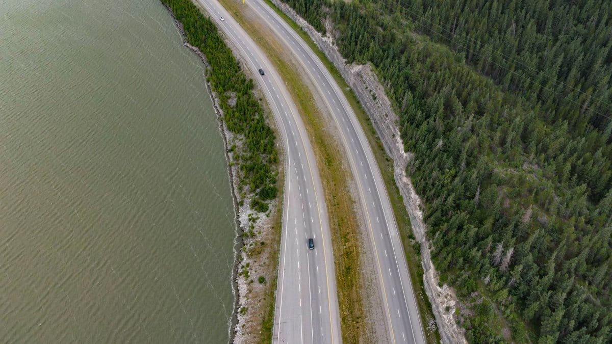
Freeway conversion is often sold as cleaner because cars spend less time idling at lights. That can be true for some pollutants in some conditions. It is not the whole health story. Higher speeds and higher volumes, if the smoother road attracts more trips, can raise noise and keep emissions concentrated along the same neighborhoods. Homes, playgrounds, and senior buildings already sit close to the pavement. A wider footprint for ramps can bring traffic nearer to windows that were already too near.
Public health advocates in the north metro have pressed MnDOT to treat air and noise as design constraints, not as appendices filed after the lanes are drawn. Sound walls help some blocks and shadow others. They do little for people who must cross. Filtration in nearby buildings is a mitigation, not a substitute for siting. Residents who comment this week can ask where monitors would go, what thresholds would trigger more mitigation, and who pays if the built project performs worse than the model.
Property, storefronts, and the right of way
Any interchange heavy design consumes land. Some of that land is already public right of way. Some is not. Even when a house is not taken, a new ramp can cut a parking lot, remove a familiar entrance, or leave a small business facing a frontage road with less pass by traffic. Owners want timelines. Tenants want to know if a lease survives construction. Cities want tax base that does not vanish for a decade of orange barrels.
MnDOT typically describes acquisition as a last resort governed by federal and state rules, with compensation and relocation assistance where the law requires it. Those sentences reassure people who have never been through a taking. They reassure less the owner who has watched a study line creep toward a lot line for years. Clear maps, parcel level explanations, and a plain account of what is still undecided would do more than another general brochure. The comment window is one of the last formal chances to put a specific property concern into the file.
Traffic models and the trips they assume

Forecasts sit underneath every lane diagram. If the model assumes steady growth in regional driving, the freeway looks necessary. If the model assumes more transit, more remote work, or slower population growth, some of the width looks optional. Models are tools, not oracles. They encode choices about land use, fuel prices, and whether people keep driving the way they did before recent disruptions. Neighbors are right to ask which assumptions survived and which were retired.
There is also induced demand, the plain observation that easier driving can invite more driving. A road that no longer stops may carry more vehicles in a few years than the year it opens. That does not automatically doom the project. It does mean safety gains should be judged against a future volume, not only against today. Hwy 252 MnDOT plans should be read with that humility. A comment that asks for the forecast year, the no build comparison, and the sensitivity tests is a comment an agency can actually answer.
How to comment before the door closes

The agency has framed this week as the last opportunity for the public to react before the process moves toward a more fixed recommendation. Meetings are meant for questions, maps, and staff who can explain why one interchange sits where it does. Written comments, accepted through December 22, 2026, become part of the record in a way a hallway conversation does not. People who cannot attend still have a route in, if they use it.
Effective comments tend to be specific. Name the cross street. Describe the trip that would break. Ask what happens to a bus route, a bike crossing, or a loading dock. Ask how construction years will be staged so that local access does not collapse all at once. Anger is understandable after a long study. Precision travels farther inside an engineering review. A short note that says only no is easy to acknowledge and hard to design around.
What officials say is still open

Project staff usually distinguish between decisions already narrowed and details still in play. Lane count, interchange type, wall locations, local street connections, and mitigation packages do not all freeze on the same day. Residents often hear a softer message in the room and a harder one in the schedule. If this is truly the last comment round, the public deserves a list of what comment can still change. Without that list, participation feels ceremonial.
Cities along the route have their own leverage, through municipal consent, local street ownership, and political pressure on legislators who fund the work. Alignment between city councils and neighborhood groups is not guaranteed. A council may want the crashes gone and the tax base protected at the same time. That is a legitimate civic tension, not a betrayal. The state process should show where city comments diverged from resident comments, rather than folding both into a single word of support.
Trust, equity, and a long memory

Trust is the scarce material on this corridor. Studies have overlapped. Names of alternatives have shifted. People who showed up five years ago are being asked to show up again, with jobs and caregiving that did not pause for the environmental review. Some hear the latest meetings as genuine closure. Others hear a timetable designed to outlast opposition. Both readings can attach to the same set of slides.
Equity language in transportation has become common, and residents have learned to test it. Does the preferred design reduce exposure for the blocks with the least choice about where to live? Does transit get a real path through construction and after opening, or only a sentence in the purpose and need? Are engagement materials offered in the languages spoken in the apartment buildings nearest the ramps? Hwy 252 MnDOT plans will be judged on those tests as much as on travel time saved for through trips.
Money, sequence, and the years of construction

Even a well liked design is only a plan until it is funded and staged. Large freeway work competes with bridges, bus rapid transit, and maintenance backlogs across the state. A comment period can end while the money is still uncertain. That gap matters. Communities can endure a decision. They struggle more with a decision that then sits, half promised, while property and business plans freeze.
Construction itself is a multi year neighbor. Detours push traffic onto streets never meant for it. Night work trades one hardship for another. Small businesses lose visibility. If the state wants consent that lasts past the ribbon cutting, the staging plan should be as public as the interchange sketches. People can accept dust for a reason they understand. They resent dust that arrives without a calendar.
What a final comment can still do

I have sat in enough hearing rooms to know that a single letter rarely redraws a freeway. The record still matters. It is what a city attorney, a legislator, or a future lawsuit reads when someone asks whether the public was heard. It is also what designers use when a ramp can shift a little and spare a crossing that residents named in plain language. Silence is easy to interpret as consent, even when it is only fatigue.
The choice in front of Brooklyn Park and Brooklyn Center is not between a perfect road and a neglected one. It is between a signalized corridor with known failures and a freeway with known tradeoffs, documented under Hwy 252 MnDOT plans that are nearing the end of open comment. Through December 22, 2026, residents can still insist that safety, access, health, and local streets be counted in the same sentence. After that date, the argument moves into a narrower room. The people who live beside the lights should not leave that room to speak only for them.