
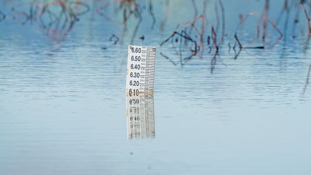
On a gray Saturday morning in Sausalito, a man in rubber boots stood at the edge of a parking lot and watched the bay refuse to give the pavement back. The water had peaked overnight, then stalled, leaving a thin sheet across curbs that usually stay dry even in winter storms. Similar scenes played out from the Embarcadero to shoreline parks in the East Bay, where puddles behaved less like leftovers from a storm and more like a tide that had forgotten its schedule. Officials responded by keeping Bay Area flood advisories in place through the weekend, a decision that surprised people who had expected the danger to ebb with the morning light. The extension was not a new emergency so much as an admission that retreat can be slower than arrival, and that a record does not end when the crest passes.
An advisory that outlasted the peak

Coastal flood advisories are easy to misread. They do not always mean a wall of water or a sudden evacuation. In the Bay Area they often describe a narrower problem: salt water pushing into streets, lots, trails, and low businesses when tides run high and winds pile the bay against the shore. The latest round began with water levels that broke local records, then lingered because the decline was slower than forecasters had expected. That gap between the peak and the cleanup is where an extension lives.
For people who only glance at a phone alert, the word extended can sound like bureaucracy stretching a headline. On the ground it is more practical. Crews cannot safely reopen a flooded underpass until the water drops and inspectors check for debris, damaged signals, and weakened pavement. Park staff cannot assume a path is merely wet when the bay has been sitting on it for hours. A slower fall in the gauge means a longer list of places that are still not ordinary.
Residents who have lived through previous king tides recognized the pattern and still found this one unsettling. The water did not have to keep rising to remain a problem. It only had to refuse to leave on the timetable everyone had mentally booked.
What record water actually looked like

Records are tidy in a table and messy at the curb. Along the San Francisco waterfront, observers described water covering walkways that usually sit a comfortable step above the bay. In Marin, parking lots near the shore turned into shallow lagoons. In parts of the East Bay, trail users met water where they expected gravel. None of this required a cinematic surge. It required a tide high enough, long enough, and paired with weather that kept the bay from draining back on cue.
The phrase record high can flatten those differences. A marina and a residential block do not experience the same inch of water in the same way. At a dock, a few extra inches may mean lines pulled tight and fingers of water on a ramp. On a street with poor drainage, the same inches can trap cars, short electrical gear, and send sheets of water toward doorways. The advisory exists to cover that range without pretending every block faces the same risk.
People compared notes in the way Bay Area residents often do, by neighborhood rather than by region. Someone in Alameda asked whether the ferry lot was passable. Someone in San Rafael asked about a road that floods in a hard rain even when the tide is ordinary. The answers were local, which is another way of saying the record was not one event. It was many small disruptions sharing a cause.
Why the water fell more slowly than expected
Tides are predictable in their broad rhythm and stubborn in their details. Astronomical tables can tell you when a high tide should arrive. They cannot fully tell you how wind, atmospheric pressure, distant swell, and the shape of the bay will alter the result. When several of those factors lean the same way, water can stand higher for longer than a simple forecast curve suggests. That appears to be what happened here. Levels shattered records, then declined with a reluctance that forced agencies to revisit their end times.
A slow decline is not the same as a second storm. It can still be dangerous, especially at night, when a driver sees a shine on the asphalt and cannot tell depth. Salt water is particularly unkind to brakes, wiring, and the joints of older buildings. It also lingers in storm drains, mixing with urban runoff and leaving a residue that maintenance crews will be dealing with after the alert itself is gone.
Forecasters are often blamed for caution and then blamed again for surprise. In this case the surprise was not that high water came. It was that the retreat misbehaved. Extending the advisory was a way of saying the model and the shoreline had not yet agreed.
Streets, ferries, and the ordinary day
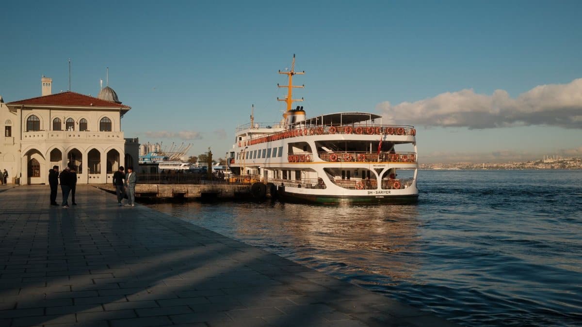
The most costly effects of coastal flooding are rarely the photographs. They are the missed shifts, the rerouted buses, the parents who cannot reach a school pickup because a familiar ramp is closed, and the small businesses that lose a Saturday when foot traffic disappears. Ferry riders watched schedules with extra attention. Cyclists who treat the bay trail as a commute found detours that added time they had not planned to spend. Delivery drivers learned, again, which blocks look fine on a map and are not fine in a tide.
Public agencies urged people to avoid driving through standing water, a warning that sounds obvious until you are late and the alternate route is also slow. Even a few inches can lift a car enough to steal traction. Deeper water hides curbs and open drains. The advisory language is plain because the mistake it tries to prevent is ordinary: treating a flooded street as a puddle with ambition.
Weekend timing cut both ways. Fewer commuters meant fewer people forced into the worst spots at rush hour. More visitors meant more people unfamiliar with which lots flood and which paths dead end in the bay. Hotels and waterfront restaurants fielded questions that were really about whether the day was canceled. In most places it was not. It was narrowed.
Low lying blocks and the homes behind them

Not every flooded street is a waterfront postcard. Some of the most vulnerable blocks sit behind a road, a rail line, or a modest rise that usually does the quiet work of keeping the bay out. When water finds a gap, it does not announce itself with a view. It arrives in a garage, a backyard, or a ground floor apartment where residents have learned to keep storage off the floor and still get caught.
Renters in those buildings often have fewer options than homeowners with insurance conversations already underway. A soaked carpet and a ruined refrigerator are not regional news. They are the kind of loss that does not show up in a tide gauge and still rearranges a month. Landlords and tenants do not always agree on who should have moved the car, who should have sandbagged the door, and who pays when salt water wins anyway.
City crews can pump a street. They cannot instantly dry a wall. That lag is part of why an advisory extension matters even after the dramatic photos stop. The water people can see is only the first chapter of the damage people will live with.
How officials decide the alert should continue
An advisory is a judgment, not a switch. Meteorologists and local emergency managers look at gauges, wind, the next tide cycle, and reports from the field. If water is falling but the next high tide could push it back into the same streets, ending the alert early creates a false sense of completion. If field reports show roads still closed, the paperwork should match the pavement.
Bay Area flood advisories also have to speak to a complicated shoreline. One county may be dealing with a marina and a highway shoulder. Another may be watching creeks that are not the main story but can complicate drainage when the bay is high and the outlets cannot empty. Coordination across cities is imperfect, which residents notice when one alert expires and a neighboring one does not. The inconsistency is frustrating. It is also sometimes honest. The bay does not flood on county lines.
Communication is the harder craft. A message that says the worst has passed but the advisory remains can sound contradictory if it is rushed. The clearer version is simple. The crest broke records. The drop is slow. Avoid the usual flooded spots through the weekend. Check on neighbors who might not see the update. That is not drama. It is instructions.
What patience looks like in practice

There is a style of weather advice that scolds people for living near water, as if the Bay Area could pick up its ports, parks, and apartments and set them on a hill. A more useful posture is specific. Move vehicles out of lots that flooded last time. Do not wade in water that may hide current or contamination. Keep a flashlight if your block loses power when equipment gets wet. Photograph damage for insurance before you start throwing things away. If you must travel, leave earlier and assume a closure.
Community groups often fill the space between an official alert and a knocked door. Congregations, neighborhood associations, and informal text threads have become part of how the region handles weather, not because the science is spiritual, but because people still need someone to ask whether the corner store is open and whether an older neighbor has a dry place to sit. I have watched those threads outperform a polished press release when the question is small and urgent. The advisory sets the frame. Neighbors supply the detail.
None of this requires panic. Panic is a poor tool for a slow tide. What the weekend asked for was attention, the unglamorous kind that checks a gauge twice and does not drive through the shine on the road just because the car in front did.
The records we will be measuring against

Once a water level shatters a record, it becomes the new story people tell. The next storm will be compared with this weekend, fairly or not. That can sharpen preparedness. It can also distort memory. A record tide in calm wind is not the same hazard as a modest tide in a violent rain. Residents who treat every future alert as either a repeat of the worst day or a cry of wolf will both be wrong some of the time.
Scientists and local planners have been saying for years that higher baseline water makes these coastal nuisance floods more common. You do not need a distant research paper to see the logic if you have watched the same parking lot fail in storms that used to be routine. The policy arguments about seawalls, wetlands, zoning, and who pays will continue long after this advisory expires. They should. An extended alert is a short document. The shoreline question is not.
Still, it would be a mistake to turn every wet Saturday into a referendum. People need to get to work, open shops, and walk dogs. The immediate task is narrower: respect the water that is actually there, not the water of the argument.
A weekend measured in inches

By Sunday, the drama had already thinned into logistics. Some lots reopened. Some paths remained closed. The bay looked, to a casual glance, like itself again, which is how these events trick the eye. Inches do not photograph like waves. They still decide whether a door seal holds and whether a bus can make its loop.
Bay Area flood advisories remained the official language for that in between time, the hours when the record was no longer being set and the mess was not yet finished. That is an awkward place for public attention, which prefers beginnings and endings. Weather, especially on this shoreline, prefers middles.
If there is a lesson worth keeping after the gauges fall, it is modest. Believe the extension when the water is slow to leave. Ask a local question rather than a regional one. And treat a quiet street with a skin of bay water as unfinished business, not as a picture that has already passed.